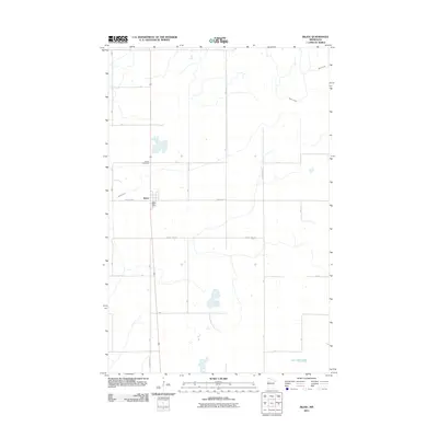
2011 Map of Bejou
USGS Topo · Published 2011About this map
Bejou serves as the primary settlement on this Northwest Minnesota landscape, centered at the junction of County Hwy-1 and the north-south corridor that passes the Bejou Post Office. The surrounding terrain is defined by the gentle drainage of Marsh Creek, which meanders through the northern and western sections of the township, and the presence of Twin Oaks Lake in the southeast. This 2011 survey documents a highly organized rural grid, where local transit is facilitated by a network of designated routes including County Hwy-34 and County Hwy-123. For those researching local history or genealogy, the Bejou Cemetery is clearly marked just north of the town center, providing a specific point of reference for family histories in Mahnomen County.
Find a feature on this map
18 named features on this map. Tap any name to fly to it.
Don’t see what you’re looking for? This feature index may not catch every label — zoom into the map to look around manually.
Map Details
Editions of this 2011 Bejou Map
This is the sole edition of this map. No revisions or reprints were ever made.
Other maps of this area

1919 · Valley
USGS Topo · 1:62,500

1952 · Grand Forks
USGS Topo · 1:250,000

1954 · Bemidji
USGS Topo · 1:250,000

1956 · Grand Forks
USGS Topo · 1:250,000

1957 · Bemidji
USGS Topo · 1:250,000

1958 · Bemidji
USGS Topo · 1:250,000

1966 · Grand Forks
USGS Topo · 1:250,000

1966 · Union Lake
USGS Topo · 1:24,000
1966 · Faith
USGS Topo · 1:24,000
1966 · Faith NE
USGS Topo · 1:24,000