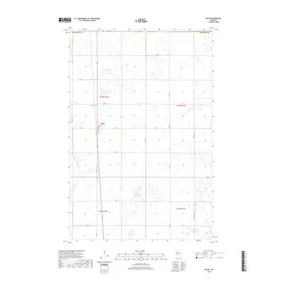
2019 Map of Bejou
USGS Topo · Published 2019About this map
Bejou serves as the central hub of this agricultural landscape in Mahnomen County, situated along the north-south corridor of Roosevelt Ave. The settlement is closely supported by the Bejou Cem to the north, reflecting the long-standing community roots in the region. The terrain is defined by a dense network of wetlands and small water bodies characteristic of the Minnesota prairie-pothole region, with Marsh Cr winding through the southwestern sections and Twin Oaks Lake appearing in the southeast. A rigid section-line road grid, including 460th St SE and 170th Ave, organizes the land into productive tracts. This 2019 data illustrates the persistent rural character of the area, where water features like Creek 130 and various unnamed marshes dictate the placement of farmsteads and transport routes.
Find a feature on this map
24 named features on this map. Tap any name to fly to it.
Don’t see what you’re looking for? This feature index may not catch every label — zoom into the map to look around manually.
Map Details
Editions of this 2019 Bejou Map
This is the sole edition of this map. No revisions or reprints were ever made.
Other maps of this area

1919 · Valley
USGS Topo · 1:62,500

1952 · Grand Forks
USGS Topo · 1:250,000

1954 · Bemidji
USGS Topo · 1:250,000

1956 · Grand Forks
USGS Topo · 1:250,000

1957 · Bemidji
USGS Topo · 1:250,000

1958 · Bemidji
USGS Topo · 1:250,000

1966 · Grand Forks
USGS Topo · 1:250,000

1966 · Union Lake
USGS Topo · 1:24,000
1966 · Faith
USGS Topo · 1:24,000
1966 · Faith NE
USGS Topo · 1:24,000