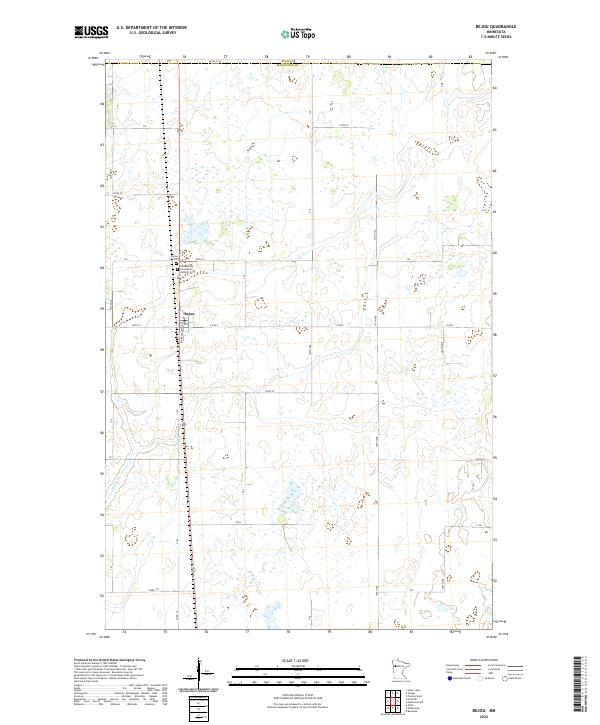
2022 Map of Bejou
USGS Topo · Published 2022About this map
Bejou serves as the central hub of this agricultural landscape along the northern border of Mahnomen County. The settlement is defined by a grid of local thoroughfares including Roosevelt Ave and Co Rd 1, which connect the town to the surrounding farmstead sections. For those tracing local heritage, the map identifies the Bejou Cem and the Immaculate Conception Catholic Cem, both situated near the town site. The terrain is characterized by a high density of wetlands and small water bodies typical of this region of Minnesota, with Marsh Cr and Creek 130 providing the primary drainage across the township lines. The boundary between Polk Co and Mahnomen Co runs along the northern edge of the sheet, marked by 460th St SE.
Find a feature on this map
22 named features on this map. Tap any name to fly to it.
Don’t see what you’re looking for? This feature index may not catch every label — zoom into the map to look around manually.
Map Details
Editions of this 2022 Bejou Map
This is the sole edition of this map. No revisions or reprints were ever made.
Other maps of this area

1919 · Valley
USGS Topo · 1:62,500

1952 · Grand Forks
USGS Topo · 1:250,000

1954 · Bemidji
USGS Topo · 1:250,000

1956 · Grand Forks
USGS Topo · 1:250,000

1957 · Bemidji
USGS Topo · 1:250,000

1958 · Bemidji
USGS Topo · 1:250,000

1966 · Grand Forks
USGS Topo · 1:250,000

1966 · Union Lake
USGS Topo · 1:24,000
1966 · Faith
USGS Topo · 1:24,000
1966 · Faith NE
USGS Topo · 1:24,000