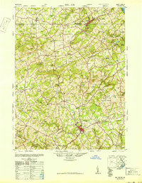
1948 Map of Belair
USGS Topo · Published 1948About this map
Maryland and Pennsylvania rail lines connect the rural communities of Harford County and York County in the years following World War II. The landscape is defined by the winding course of Deer Creek and its many tributaries, supporting a network of small crossroad settlements such as Whiteford, Pylesville, and Dublin. Higher elevations like Federal Hill provide landmarks among the scattered farmsteads and orchards. Cultural life is deeply rooted in local institutions, evidenced by the numerous country meeting houses and schools, including the Broad Creek Meeting House and the Susquehanna Hall School. Near the state border, the presence of Talc and Flint extraction sites near Delta and Cardiff points to the area's mineral history, while the Race Track near Bel Air reflects mid-century recreational interests in the Maryland countryside.
Find a feature on this map
135 named features on this map. Tap any name to fly to it.
Don’t see what you’re looking for? This feature index may not catch every label — zoom into the map to look around manually.
Map Details
Editions of this 1948 Belair Map
2 editions found
Other maps of this area

1893 · Gunpowder
USGS Topo · 1:62,500

1894 · Baltimore
USGS Topo · 1:62,500

1898 · Tolchester
USGS Topo · 1:125,000

1899 · Baltimore
USGS Topo · 1:62,500

1900 · Havre De Grace
USGS Topo · 1:62,500

1900 · Betterton
USGS Topo · 1:62,500

1900 · Parkton
USGS Topo · 1:62,500

1901 · Belair
USGS Topo · 1:62,500

1901 · Gunpowder
USGS Topo · 1:62,500

1902 · Parkton
USGS Topo · 1:62,500