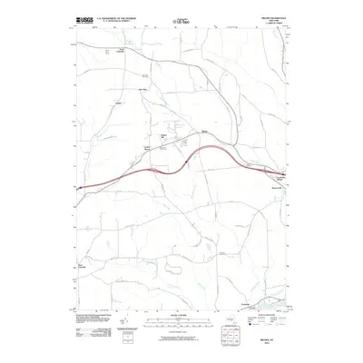
2010 Map of Belden
USGS Topo · Published 2010About this map
The Susquehanna River cuts across the southeastern corner of this landscape, anchoring the settlement of Ouaquaga where the Ouaquaga Post Office stands near the riverbank. The terrain is defined by the prominent Belden Hill, which overlooks a mix of residential areas like Country Manor and recreational spaces such as the Belden Hill Golf Course. A network of smaller waterways, including Belden Brook, Sage Creek, and Still Creek, drains the rolling landscape toward the river.
Find a feature on this map
70 named features on this map. Tap any name to fly to it.
Don’t see what you’re looking for? This feature index may not catch every label — zoom into the map to look around manually.
Map Details
Editions of this 2010 Belden Map
This is the sole edition of this map. No revisions or reprints were ever made.
Other maps of this area

1902 · Coventry
USGS Topo · 1:62,500

1904 · Binghamton
USGS Topo · 1:62,500

1904 · Greene
USGS Topo · 1:62,500

1904 · Oxford
USGS Topo · 1:62,500

1905 · Nineveh
USGS Topo · 1:62,500

1935 · Chenango Forks
USGS Topo · 1:24,000

1937 · Binghamton East
USGS Topo · 1:24,000

1942 · Chenango Forks
USGS Topo · 1:31,680

1942 · Binghamton East
USGS Topo · 1:31,680
1948 · Greene
USGS Topo · 1:24,000