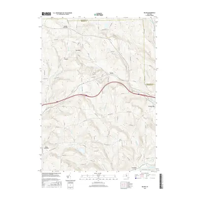
2016 Map of Belden
USGS Topo · Published 2016About this map
Harpursville and Belden anchor this landscape where the Susquehanna River cuts through the southeastern corner of Broome County. The area is defined by a series of small, scattered settlements including North Colesville, West Colesville, and the aptly named Tunnel, which reflects the region's historical engineering. Genealogy researchers will find several well-documented burial grounds, including New Ohio Cem, Pratts Cem, and Coles Hill Cem, which are tucked away near local waterways like Belden Brook and Ouaquaga Cr. The terrain is crisscrossed by a dense network of country roads like Altitude Hill Rd and Beartown Rd, marking the agricultural and residential patterns of the town of Fenton and its neighbors. To the north, the Mill Pond and Osborne Cr showcase the intricate drainage system feeding into the larger river valley.
Find a feature on this map
84 named features on this map. Tap any name to fly to it.
Don’t see what you’re looking for? This feature index may not catch every label — zoom into the map to look around manually.
Map Details
Editions of this 2016 Belden Map
This is the sole edition of this map. No revisions or reprints were ever made.
Other maps of this area

1902 · Coventry
USGS Topo · 1:62,500

1904 · Binghamton
USGS Topo · 1:62,500

1904 · Greene
USGS Topo · 1:62,500

1904 · Oxford
USGS Topo · 1:62,500

1905 · Nineveh
USGS Topo · 1:62,500

1935 · Chenango Forks
USGS Topo · 1:24,000

1937 · Binghamton East
USGS Topo · 1:24,000

1942 · Chenango Forks
USGS Topo · 1:31,680

1942 · Binghamton East
USGS Topo · 1:31,680
1948 · Greene
USGS Topo · 1:24,000