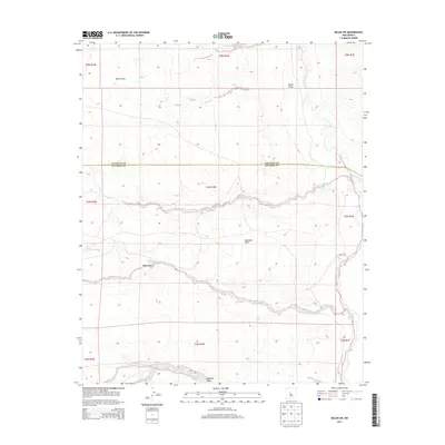
2013 Map of Belen SW
USGS Topo · Published 2013About this map
The Rio Puerco carves a prominent north-south path through the eastern portion of this high desert landscape, defining the local hydrology and drainage patterns of the region. This 2013 topographic survey captures the intricate network of seasonal watercourses and arroyos that feed into the river valley, including the winding Arroyo Comanche and Arroyo Alamito. The terrain transitions from the elevated, level expanses of Montano Flats into a series of deeply etched drainage features such as Pedro Draw, Coyote Draw, and Mariano Draw. Straddling the political boundary between Valencia Co and Socorro Co, the map reveals a sparsely developed environment dominated by natural landforms and the Public Land Survey System grids. The spatial relationship between these natural features provides insight into the arid geography south of Belen, where the presence of water—even ephemeral—has long dictated the boundaries and movement through the New Mexico interior.
Find a feature on this map
17 named features on this map. Tap any name to fly to it.
Don’t see what you’re looking for? This feature index may not catch every label — zoom into the map to look around manually.
Map Details
Editions of this 2013 Belen SW Map
This is the sole edition of this map. No revisions or reprints were ever made.
Other maps of this area

1916 · La Joya
USGS Topo · 1:125,000

1917 · Cerro Verde
USGS Topo · 1:125,000

1952 · La Joya NW
USGS Topo · 1:24,000

1952 · Belen SW
USGS Topo · 1:24,000

1952 · Belen
USGS Topo · 1:24,000

1952 · Veguita
USGS Topo · 1:24,000

1952 · Belen NW
USGS Topo · 1:24,000

1952 · Abeytas
USGS Topo · 1:24,000

1954 · Socorro
USGS Topo · 1:250,000

1956 · Mesa Aparejo
USGS Topo · 1:62,500