
1952 Map of Abeytas
USGS Topo · Published 1953About this map
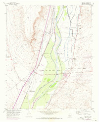
The Rio Grande valley in Socorro County is defined by a complex irrigation network of drains and laterals that support traditional agricultural settlements. This 1952 survey details the land tenure of several historic land grants, including the Casa Colorada Grant, Belen Grant, and Sevilleta Grant, whose boundaries intersect at the river. Small villages like Abeytas and Las Nutrias are mapped alongside the vital Atchison Topeka and Santa Fe railroad line. The map shows the confluence where the Rio Puerco joins the main valley, a landscape shaped by water management features like the San Juan Canal and Belen Riverside Drain. Community life is anchored by local landmarks such as the San Isidro Church and the Abeytas Cemetery, while the New Mexico Boys Ranch appears as a significant modern institutional presence near Pino Draw.
Find a feature on this map
41 named features on this map. Tap any name to fly to it.
Don’t see what you’re looking for? This feature index may not catch every label — zoom into the map to look around manually.
Map Details
Editions of this 1952 Abeytas Map
4 editions found
Other maps of this area

1916 · La Joya
USGS Topo · 1:125,000

1952 · La Joya NW
USGS Topo · 1:24,000

1952 · San Anacia
USGS Topo · 1:24,000

1952 · Belen SW
USGS Topo · 1:24,000

1952 · Black Butte
USGS Topo · 1:24,000

1952 · La Joya
USGS Topo · 1:24,000

1952 · Turn
USGS Topo · 1:24,000

1952 · Veguita
USGS Topo · 1:24,000

1952 · Becker SW
USGS Topo · 1:24,000

1954 · Socorro
USGS Topo · 1:250,000