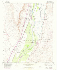
1952 Map of Abeytas
USGS Topo · Published 1973About this map
The Rio Grande valley dominates this mid-century landscape, revealing an intricate network of irrigation and water management essential to life in Socorro County. Agricultural engineering is on full display through the Sabinal Lateral, San Juan Canal, and several riverside drains that lace the valley floor. Settlement is concentrated along these water sources and the Atchison Topeka and Santa Fe railroad line, with small communities like Abeytas and Las Nutrias serving as focal points for local heritage.
Find a feature on this map
36 named features on this map. Tap any name to fly to it.
Don’t see what you’re looking for? This feature index may not catch every label — zoom into the map to look around manually.
Map Details
Editions of this 1952 Abeytas Map
4 editions found
Other maps of this area

1916 · La Joya
USGS Topo · 1:125,000

1952 · La Joya NW
USGS Topo · 1:24,000

1952 · San Anacia
USGS Topo · 1:24,000

1952 · Belen SW
USGS Topo · 1:24,000

1952 · Black Butte
USGS Topo · 1:24,000

1952 · La Joya
USGS Topo · 1:24,000

1952 · Turn
USGS Topo · 1:24,000

1952 · Veguita
USGS Topo · 1:24,000

1952 · Becker SW
USGS Topo · 1:24,000

1952 · Abeytas
USGS Topo · 1:24,000