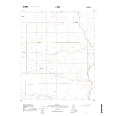
2020 Map of Belen SW
USGS Topo · Published 2020About this map
Rio Puerco defines the eastern edge of this arid landscape, winding through a complex system of drainage channels. The high ground is dominated by Montano Flats, a broad plateau dissected by several significant ephemeral watercourses. To the north, Pedro Draw feeds into the main river channel, while the southern reaches are marked by the branching paths of Arroyo Alamito and Mariano Draw. This 2020 survey highlights the boundary between Valencia and Socorro counties, showing a region largely defined by its natural topography and the watershed of Arroyo Comanche. The map provides a precise look at the Public Land Survey System grid, illustrating how township and range lines intersect with the meandering path of the river.
Find a feature on this map
16 named features on this map. Tap any name to fly to it.
Don’t see what you’re looking for? This feature index may not catch every label — zoom into the map to look around manually.
Map Details
Editions of this 2020 Belen SW Map
This is the sole edition of this map. No revisions or reprints were ever made.
Other maps of this area

1916 · La Joya
USGS Topo · 1:125,000

1917 · Cerro Verde
USGS Topo · 1:125,000

1952 · La Joya NW
USGS Topo · 1:24,000

1952 · Belen SW
USGS Topo · 1:24,000

1952 · Belen
USGS Topo · 1:24,000

1952 · Veguita
USGS Topo · 1:24,000

1952 · Belen NW
USGS Topo · 1:24,000

1952 · Abeytas
USGS Topo · 1:24,000

1954 · Socorro
USGS Topo · 1:250,000

1956 · Mesa Aparejo
USGS Topo · 1:62,500