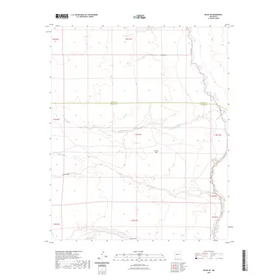
2023 Map of Belen SW
USGS Topo · Published 2023About this map
Rio Puerco defines the eastern boundary of this arid landscape, meandering through a series of dramatic bends as it flows southward along the border of the quadrangle. The terrain is characterized by a series of significant drainage systems, including Arroyo Comanche and Arroyo Alamito, which cut westward across the central and southern sections. These natural features illustrate the complex hydrology of the high desert basin. In the heart of the region, the broad expanse of Montano Flats occupies the higher ground between the arroyos. The map also delineates the jurisdictional boundary between Valencia County and Socorro County, providing a clear record of administrative divisions in this largely uninhabited territory during the early twenty-first century. Minor features like Coyote Draw and Pedro Draw further detail the subtle topography of the basin floor.
Find a feature on this map
8 named features on this map. Tap any name to fly to it.
Don’t see what you’re looking for? This feature index may not catch every label — zoom into the map to look around manually.
Map Details
Editions of this 2023 Belen SW Map
This is the sole edition of this map. No revisions or reprints were ever made.
Other maps of this area

1916 · La Joya
USGS Topo · 1:125,000

1917 · Cerro Verde
USGS Topo · 1:125,000

1952 · La Joya NW
USGS Topo · 1:24,000

1952 · Belen SW
USGS Topo · 1:24,000

1952 · Belen
USGS Topo · 1:24,000

1952 · Veguita
USGS Topo · 1:24,000

1952 · Belen NW
USGS Topo · 1:24,000

1952 · Abeytas
USGS Topo · 1:24,000

1954 · Socorro
USGS Topo · 1:250,000

1956 · Mesa Aparejo
USGS Topo · 1:62,500