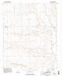
1991 Map of Belen SW
USGS Topo · Published 1996About this map
The Belen Grant dominates the eastern landscape of this New Mexico quadrangle, where the Rio Puerco flows through a terrain defined by complex drainage networks. This 1991 revision, based on much earlier imagery, illustrates an arid expanse where the New Mexico Principal Meridian serves as a critical survey anchor. The land is carved by numerous dry watercourses including Arroyo Monte Belen, Arroyo Comanche, and Arroyo Alamito, which cut through the high ground of Montano Flats. The mapping reveals a sparse network of 4wd trails, indicating the limited human infrastructure in this section of the state. It provides a technical look at the geological and survey history of the region, specifically noting where the west boundary of the Belen Grant is omitted due to a lack of historical data near the river.
Find a feature on this map
12 named features on this map. Tap any name to fly to it.
Don’t see what you’re looking for? This feature index may not catch every label — zoom into the map to look around manually.
Map Details
Editions of this 1991 Belen SW Map
This is the sole edition of this map. No revisions or reprints were ever made.
Other maps of this area

1916 · La Joya
USGS Topo · 1:125,000

1917 · Cerro Verde
USGS Topo · 1:125,000

1952 · La Joya NW
USGS Topo · 1:24,000

1952 · Belen SW
USGS Topo · 1:24,000

1952 · Belen
USGS Topo · 1:24,000

1952 · Veguita
USGS Topo · 1:24,000

1952 · Belen NW
USGS Topo · 1:24,000

1952 · Abeytas
USGS Topo · 1:24,000

1954 · Socorro
USGS Topo · 1:250,000

1956 · Mesa Aparejo
USGS Topo · 1:62,500