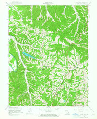
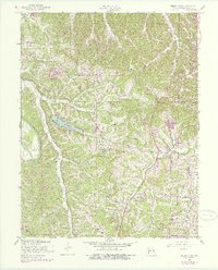
1954 Map of Belew Creek
USGS Topo · Published 1964About this map
The Big River carves a winding path along the western edge of this mid-century Jefferson County survey, defining a landscape of deep valleys and prominent ridges. Dominating the central terrain is Lake Tishomingo, a significant reservoir surrounded by the narrow, timbered spurs of Sand Ridge. The mapping from this era reveals a network of rural homesteads and early twentieth-century settlements like Regina and Goldman, which are connected by winding valley roads following the courses of Belew Creek and Sandy Creek.
Find a feature on this map
27 named features on this map. Tap any name to fly to it.
Don’t see what you’re looking for? This feature index may not catch every label — zoom into the map to look around manually.
Map Details
Editions of this 1954 Belew Creek Map
5 editions found
Other maps of this area

1901 · De Soto
USGS Topo · 1:125,000

1912 · Kimmswick
USGS Topo · 1:62,500

1915 · Crystal City
USGS Topo · 1:62,500

1916 · Kimmswick
USGS Topo · 1:62,500

1930 · De Soto NE
USGS Topo · 1:24,000

1930 · Pacific SE
USGS Topo · 1:24,000

1931 · Pacific NE
USGS Topo · 1:24,000

1937 · Pacific
USGS Topo · 1:24,000

1937 · Fletcher
USGS Topo · 1:24,000

1938 · Cedar Hill
USGS Topo · 1:24,000