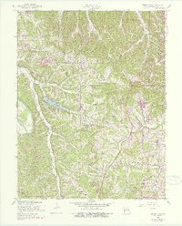
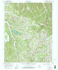
1954 Map of Belew Creek
USGS Topo · Published 1975About this map
Meramec Sand Ridge dominates the northern portion of this Jefferson County landscape, where the ridges and hollows funnel numerous waterways toward the Big River and Sandy Creek. The 1954 field check, updated with purple photorevisions from the late 1960s and early 1970s, captures a transition from rural homesteads to more established residential and educational developments. Central to this growth is Lake Tishomingo, a prominent water feature surrounded by winding roads.
Find a feature on this map
36 named features on this map. Tap any name to fly to it.
Don’t see what you’re looking for? This feature index may not catch every label — zoom into the map to look around manually.
Map Details
Editions of this 1954 Belew Creek Map
5 editions found
Other maps of this area

1901 · De Soto
USGS Topo · 1:125,000

1912 · Kimmswick
USGS Topo · 1:62,500

1915 · Crystal City
USGS Topo · 1:62,500

1916 · Kimmswick
USGS Topo · 1:62,500

1930 · De Soto NE
USGS Topo · 1:24,000

1930 · Pacific SE
USGS Topo · 1:24,000

1931 · Pacific NE
USGS Topo · 1:24,000

1937 · Pacific
USGS Topo · 1:24,000

1937 · Fletcher
USGS Topo · 1:24,000

1938 · Cedar Hill
USGS Topo · 1:24,000