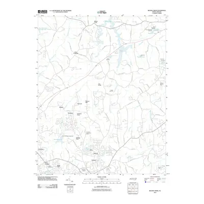
2010 Map of Belews Creek
USGS Topo · Published 2010About this map
Belews Lake dominates the northern reaches of this landscape, its dendritic shoreline reaching into the drainage basins of Belews Creek and West Belews Creek. This area of North Carolina shows a complex pattern of suburban development and water management north of Kernersville, where numerous private and municipal reservoirs like Kernersville Lake and Walkers Lake punctuate the terrain. The map details a network of established residential communities such as Crims Crossroads, Bonanza Hills, and Kimberly Acres, which are woven between agricultural lands and small aviation facilities like the K-Ville Air Incorporated Airport. To the south, the headwaters of the Haw River and Beaver Creek emerge near the County Line Rd, illustrating the region's position as a local hydrological divide. Transportation is defined by a dense web of secondary roads like Piney Grove Rd and Goodwill Church Rd, connecting historical crossing points and modern subdivisions.
Find a feature on this map
94 named features on this map. Tap any name to fly to it.
Don’t see what you’re looking for? This feature index may not catch every label — zoom into the map to look around manually.
Map Details
Editions of this 2010 Belews Creek Map
This is the sole edition of this map. No revisions or reprints were ever made.
Other maps of this area

1950 · Winston-Salem East
USGS Topo · 1:24,000

1951 · Winston-Salem East
USGS Topo · 1:24,000

1951 · Guilford
USGS Topo · 1:24,000

1951 · Walkertown
USGS Topo · 1:24,000

1953 · Winston-Salem
USGS Topo · 1:250,000

1953 · Greensboro
USGS Topo · 1:250,000

1954 · Greensboro
USGS Topo · 1:250,000

1955 · Winston-Salem
USGS Topo · 1:250,000

1962 · Winston-Salem
USGS Topo · 1:250,000

1962 · Greensboro
USGS Topo · 1:250,000