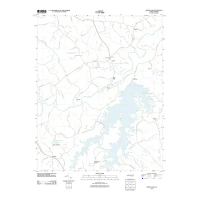
2010 Map of Belews Lake
USGS Topo · Published 2010About this map
Belews Lake dominates the southern half of this landscape, its intricate shoreline created by the impoundment of Belews Creek and West Belews Creek. The industrial character of the region is anchored by the Belews Creek Dam and the heavy infrastructure near Duke Power Steam Plant Rd. To the north, the Dan River meanders past the settlements of Pine Hall and Ceramic, where the terrain transitions from the utility-focused lakefront to a mix of wooded creek valleys and agricultural plots. This 2010 survey highlights a community balancing large-scale power generation with traditional rural landmarks. Local history is preserved at the Eden Cemetery and Mount Zion Cemetery, while recreational areas like the Riverview Golf Course and Boy Scout Pond occupy the spaces between the river and the sprawling reservoir.
Find a feature on this map
71 named features on this map. Tap any name to fly to it.
Don’t see what you’re looking for? This feature index may not catch every label — zoom into the map to look around manually.
Map Details
Editions of this 2010 Belews Lake Map
This is the sole edition of this map. No revisions or reprints were ever made.
Other maps of this area

1951 · Walkertown
USGS Topo · 1:24,000

1953 · Winston-Salem
USGS Topo · 1:250,000

1953 · Greensboro
USGS Topo · 1:250,000

1954 · Greensboro
USGS Topo · 1:250,000

1955 · Winston-Salem
USGS Topo · 1:250,000

1962 · Winston-Salem
USGS Topo · 1:250,000

1962 · Greensboro
USGS Topo · 1:250,000

1966 · Greensboro
USGS Topo · 1:250,000

1969 · Summerfield
USGS Topo · 1:24,000

1969 · Belews Creek
USGS Topo · 1:24,000