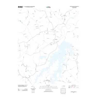
2013 Map of Belews Lake
USGS Topo · Published 2013About this map
Belews Lake dominates the southern half of this landscape, its dendritic shoreline reaching into numerous small valleys fed by creeks such as Bull Run and Belews Creek. Further north, the Dan River winds across the terrain, serving as a primary drainage for local tributaries like Eurins Creek and Reed Creek. This 2013 survey illustrates a rural community anchored by small settlements and family-named landmarks.
Find a feature on this map
123 named features on this map. Tap any name to fly to it.
Don’t see what you’re looking for? This feature index may not catch every label — zoom into the map to look around manually.
Map Details
Editions of this 2013 Belews Lake Map
This is the sole edition of this map. No revisions or reprints were ever made.
Other maps of this area

1951 · Walkertown
USGS Topo · 1:24,000

1953 · Winston-Salem
USGS Topo · 1:250,000

1953 · Greensboro
USGS Topo · 1:250,000

1954 · Greensboro
USGS Topo · 1:250,000

1955 · Winston-Salem
USGS Topo · 1:250,000

1962 · Winston-Salem
USGS Topo · 1:250,000

1962 · Greensboro
USGS Topo · 1:250,000

1966 · Greensboro
USGS Topo · 1:250,000

1969 · Summerfield
USGS Topo · 1:24,000

1969 · Belews Creek
USGS Topo · 1:24,000