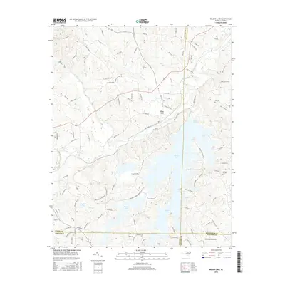
2016 Map of Belews Lake
USGS Topo · Published 2016About this map
Belews Lake dominates the central and southern portions of this landscape, its fingers reaching into the surrounding countryside where the borders of Stokes, Rockingham, Forsyth, and Guilford counties converge. Along the northern bank of the Dan River, the settlement of Pine Hall sits at the junction of Pine Hall Rd and several local routes, while the town of Stokesdale anchors the southeastern corner. This modern survey illustrates how current infrastructure interacts with the region's historic rural roots, visible in the network of family-named roads like Adkins Farm Rd and Doctor Hanes Rd. Local genealogy is anchored by sites such as Mount Zion Cem and Eden Cem, while the rugged hydrology of Town Fork Creek and Bull Run reflects the complex drainage into the larger lake and river systems that have shaped local industry and recreation for generations.
Find a feature on this map
101 named features on this map. Tap any name to fly to it.
Don’t see what you’re looking for? This feature index may not catch every label — zoom into the map to look around manually.
Map Details
Editions of this 2016 Belews Lake Map
This is the sole edition of this map. No revisions or reprints were ever made.
Other maps of this area

1951 · Walkertown
USGS Topo · 1:24,000

1953 · Winston-Salem
USGS Topo · 1:250,000

1953 · Greensboro
USGS Topo · 1:250,000

1954 · Greensboro
USGS Topo · 1:250,000

1955 · Winston-Salem
USGS Topo · 1:250,000

1962 · Winston-Salem
USGS Topo · 1:250,000

1962 · Greensboro
USGS Topo · 1:250,000

1966 · Greensboro
USGS Topo · 1:250,000

1969 · Summerfield
USGS Topo · 1:24,000

1969 · Belews Creek
USGS Topo · 1:24,000