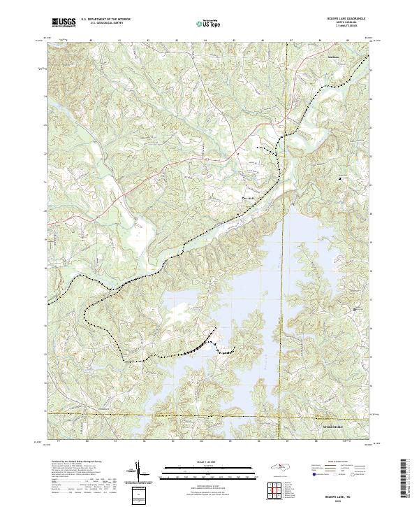
2022 Map of Belews Lake
USGS Topo · Published 2022About this map
Belews Lake dominates the central and southern reaches of this landscape, its intricate, branching fingers reaching into four North Carolina counties including Stokes, Rockingham, Forsyth, and Guilford. The northern half of the map retains its riverine character, defined by the winding Dan River and its confluence with Eurins Creek near the community of Pine Hall. This 2022 survey captures the modern road network that services the reservoir's recreational and residential developments, including the numerous loops and lanes such as Bent Plantation Lane and Old Wagon Trail. Away from the water, the map documents long-standing rural landmarks such as Eden Cemetery and Mount Zion Cemetery, which serve as anchors for local genealogy. The settlement of Stokesdale marks the southeastern corner of the quadrangle, illustrating the continued development of the Piedmont region south of Madison.
Find a feature on this map
103 named features on this map. Tap any name to fly to it.
Don’t see what you’re looking for? This feature index may not catch every label — zoom into the map to look around manually.
Map Details
Editions of this 2022 Belews Lake Map
This is the sole edition of this map. No revisions or reprints were ever made.
Other maps of this area

1951 · Walkertown
USGS Topo · 1:24,000

1953 · Winston-Salem
USGS Topo · 1:250,000

1953 · Greensboro
USGS Topo · 1:250,000

1954 · Greensboro
USGS Topo · 1:250,000

1955 · Winston-Salem
USGS Topo · 1:250,000

1962 · Winston-Salem
USGS Topo · 1:250,000

1962 · Greensboro
USGS Topo · 1:250,000

1966 · Greensboro
USGS Topo · 1:250,000

1969 · Summerfield
USGS Topo · 1:24,000

1969 · Belews Creek
USGS Topo · 1:24,000