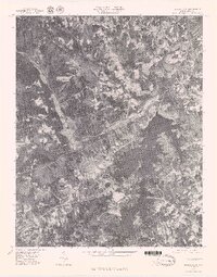
1977 Map of Belews Lake
USGS Topo · Published 1979About this map
Belews Lake dominates the southern landscape of this 1977 orthophoto, its branching arms reaching deep into the surrounding terrain. This aerial survey, produced by the Geological Survey, offers a clear view of the land as it appeared in the late 1970s, showcasing the intricate network of water and infrastructure that defines this part of Stokes County. The Dan River flows through the northern section, joined by Town Fork Creek as it winds past the settlement of Pine Hall. The transition from rural agriculture to the massive water management of the lake is evident in the photographic detail. To the south and west, the lake is fed by Belews Creek and West Belews Creek, revealing a landscape shaped by both natural drainage and modern engineering during a period of significant regional development.
Find a feature on this map
6 named features on this map. Tap any name to fly to it.
Don’t see what you’re looking for? This feature index may not catch every label — zoom into the map to look around manually.
Map Details
Editions of this 1977 Belews Lake Map
This is the sole edition of this map. No revisions or reprints were ever made.
Other maps of this area

1951 · Walkertown
USGS Topo · 1:24,000

1953 · Winston-Salem
USGS Topo · 1:250,000

1953 · Greensboro
USGS Topo · 1:250,000

1954 · Greensboro
USGS Topo · 1:250,000

1955 · Winston-Salem
USGS Topo · 1:250,000

1962 · Winston-Salem
USGS Topo · 1:250,000

1962 · Greensboro
USGS Topo · 1:250,000

1966 · Greensboro
USGS Topo · 1:250,000

1969 · Summerfield
USGS Topo · 1:24,000

1969 · Belews Creek
USGS Topo · 1:24,000