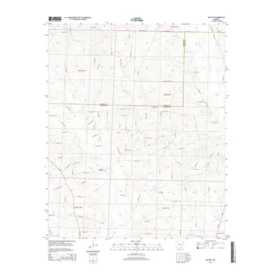
2014 Map of Belfast
USGS Topo · Published 2014About this map
The community of Belfast sits at the heart of this landscape, situated near the boundary where Saline Co meets Grant Co. This area is defined by an intricate network of waterways, including the winding paths of Dry Lost Cr, Wet Lost Cr, and Hurricane Cr. The local geography is marked by several small impoundments such as Fiser Lake and Lake Kay, which are surrounded by numerous named timber trails and access roads that speak to the region's land use. For those researching local heritage, several burial grounds are documented across the terrain, including Jones Cem, Crossroads Cem, and Corinth Cem. The map further details several smaller tributaries like Railroad Br and Kelly Br, illustrating the finely dissected drainage patterns that characterize this part of central Arkansas.
Find a feature on this map
108 named features on this map. Tap any name to fly to it.
Don’t see what you’re looking for? This feature index may not catch every label — zoom into the map to look around manually.
Map Details
Editions of this 2014 Belfast Map
This is the sole edition of this map. No revisions or reprints were ever made.
Other maps of this area

1890 · Benton
USGS Topo · 1:125,000

1891 · Little Rock
USGS Topo · 1:125,000

1893 · Little Rock
USGS Topo · 1:125,000

1894 · Benton
USGS Topo · 1:125,000

1935 · Alexander
USGS Topo · 1:48,000

1938 · Benton
USGS Topo · 1:48,000

1941 · Alexander
USGS Topo · 1:62,500

1944 · Benton
USGS Topo · 1:62,500

1944 · Spring Lake
USGS Topo · 1:31,680

1944 · Bryant
USGS Topo · 1:31,680