
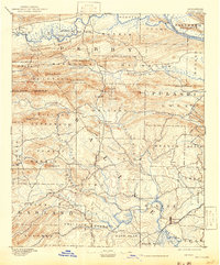
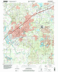
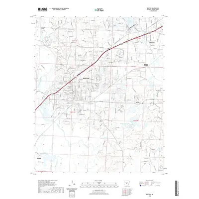
1944 Map of Benton
USGS Topo · Published 1944About this map
Benton serves as the focal point of this Saline County landscape, where the confluence of the North Fork Saline River and the Alum Fork Saline River dictates the local geography. The map reveals an area defined by its mineral wealth and institutional presence, most notably at the Bauxite Mines to the east and the sprawling grounds of the State Hospital near Haskell. This 1940s survey captures the region's transition from a rural river-valley economy to an industrial one, connected by the Missouri Pacific and Bauxite & Northern railroads. Numerous small rural centers like Congo and Tatumville are documented alongside a high density of local landmarks, including Grape Chapel and Kentucky Sch. Fords across the forks of the Saline River, such as Nelson Ford and Williams Ford, indicate where early overland travel relied on natural river crossings before modern bridge infrastructure became dominant.
Find a feature on this map
72 named features on this map. Tap any name to fly to it.
Don’t see what you’re looking for? This feature index may not catch every label — zoom into the map to look around manually.
Map Details
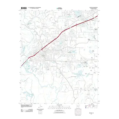
Editions of this 1944 Benton Map
This is the sole edition of this map. No revisions or reprints were ever made.
Historical Maps of Benton Through Time
12 maps found

1890 Benton
Saline County, AR
1894 Benton
Saline County, AR
1938 Benton
Saline County, AR
1944 Benton
Saline County, AR
1944 Benton
Saline County, AR
1974 Benton
Saline County, AR
1994 Benton
Saline County, AR
2011 Benton
Saline County, AR
2014 Benton
Saline County, AR
2017 Benton
Saline County, AR
2020 Benton
Saline County, AR
2024 Benton
Saline County, AR