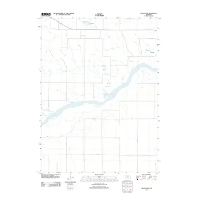
2011 Map of Belgrade SE
USGS Topo · Published 2011About this map
The Loup River carves a wide path across this Merrick County landscape, where agriculture is shaped by the presence of several private water management features. Named landmarks like Voichahoske Reservoir, Kotlarz Reservoir, and Horn Reservoir indicate a reliance on surface water storage for local irrigation and farming operations. Each of these reservoirs is paired with its corresponding structure, including Voichahoske Dam, Kotlarz Dam, and Horn Dam, highlighting the human engineering required to manage Nebraska's waterways. The terrain is further defined by the drainage of Horse Creek and a rigid grid of rural roads such as Pleasant Valley Rd and Co Line Rd, reflecting a deeply established section-line development pattern common in the Platte River Valley region.
Find a feature on this map
21 named features on this map. Tap any name to fly to it.
Don’t see what you’re looking for? This feature index may not catch every label — zoom into the map to look around manually.
Map Details
Editions of this 2011 Belgrade SE Map
This is the sole edition of this map. No revisions or reprints were ever made.
Other maps of this area

1896 · Stromsburg
USGS Topo · 1:125,000

1899 · St. Paul
USGS Topo · 1:125,000

1954 · Belgrade
USGS Topo · 1:24,000

1954 · Belgrade NW
USGS Topo · 1:24,000

1955 · Belgrade SW
USGS Topo · 1:24,000

1955 · Broken Bow
USGS Topo · 1:250,000

1955 · Belgrade SE
USGS Topo · 1:24,000

1955 · Fremont
USGS Topo · 1:250,000

1956 · Broken Bow
USGS Topo · 1:250,000

1957 · Fremont
USGS Topo · 1:250,000