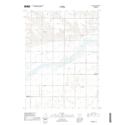
2017 Map of Belgrade SE
USGS Topo · Published 2017About this map
The Loup River dominates this landscape on the border of Merrick and Nance Counties, its broad channel and braided wetlands creating a wide corridor through the agricultural plains. Private water management is evident through several small impoundments including Voichahoske Reservoir in the north and Horn Reservoir to the east. The terrain is defined by a distinct transition from the river valley's flat bottomlands to the dissected uplands of the t16n r7w and t16n r6w townships. A dense grid of section roads, such as N Pawnee RD and Valley RD, organizes the territory into a patchwork of rural farms, while Horse Cr provides further drainage into the primary river system.
Find a feature on this map
39 named features on this map. Tap any name to fly to it.
Don’t see what you’re looking for? This feature index may not catch every label — zoom into the map to look around manually.
Map Details
Editions of this 2017 Belgrade SE Map
This is the sole edition of this map. No revisions or reprints were ever made.
Other maps of this area

1896 · Stromsburg
USGS Topo · 1:125,000

1899 · St. Paul
USGS Topo · 1:125,000

1954 · Belgrade
USGS Topo · 1:24,000

1954 · Belgrade NW
USGS Topo · 1:24,000

1955 · Belgrade SW
USGS Topo · 1:24,000

1955 · Broken Bow
USGS Topo · 1:250,000

1955 · Belgrade SE
USGS Topo · 1:24,000

1955 · Fremont
USGS Topo · 1:250,000

1956 · Broken Bow
USGS Topo · 1:250,000

1957 · Fremont
USGS Topo · 1:250,000