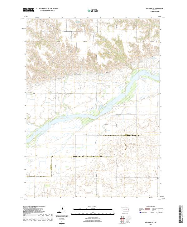
2021 Map of Belgrade SE
USGS Topo · Published 2021About this map
The Loup River dominates the central landscape of this section of Nebraska, carving a wide path through the prairie between the borders of Nance Co and Merrick Co. The terrain is characterized by a network of rural section-line roads and a series of private or agricultural water features, including Voichahoske Reservoir in the north and the smaller Horn Reservoir to the east. Several smaller drainage systems like Horse Cr feed into the primary river valley, reflecting the area's hydrology and land-use patterns. Near the center, Kotlarz Reservoir sits just off Valley Rd, illustrating the importance of water management in this agricultural region. The map preserves the exact layout of county boundaries and township lines such as t16n r7w, which have long defined the social and economic geography of the Platte River valley's northern tributaries.
Find a feature on this map
39 named features on this map. Tap any name to fly to it.
Don’t see what you’re looking for? This feature index may not catch every label — zoom into the map to look around manually.
Map Details
Editions of this 2021 Belgrade SE Map
This is the sole edition of this map. No revisions or reprints were ever made.
Other maps of this area

1896 · Stromsburg
USGS Topo · 1:125,000

1899 · St. Paul
USGS Topo · 1:125,000

1954 · Belgrade
USGS Topo · 1:24,000

1954 · Belgrade NW
USGS Topo · 1:24,000

1955 · Belgrade SW
USGS Topo · 1:24,000

1955 · Broken Bow
USGS Topo · 1:250,000

1955 · Belgrade SE
USGS Topo · 1:24,000

1955 · Fremont
USGS Topo · 1:250,000

1956 · Broken Bow
USGS Topo · 1:250,000

1957 · Fremont
USGS Topo · 1:250,000