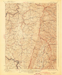
1941 Map of Belington
USGS Topo · Published 1941About this map
Belington serves as the focal point of this survey, where the Western Maryland and Baltimore and Ohio railroads converge along the banks of the Tygart River. The landscape is defined by its deep community roots, evidenced by the high density of rural schoolhouses and churches such as Sand Ridge School, St Joseph School, and Laurel Grove Church. Smaller settlements like Nestorville, Kalamazoo, and Tacy are connected by a network of winding roads and mountain runs.
Find a feature on this map
103 named features on this map. Tap any name to fly to it.
Don’t see what you’re looking for? This feature index may not catch every label — zoom into the map to look around manually.
Map Details
Editions of this 1941 Belington Map
This is the sole edition of this map. No revisions or reprints were ever made.
Other maps of this area

1886 · St. George
USGS Topo · 1:125,000

1889 · Beverly
USGS Topo · 1:125,000

1891 · St. George
USGS Topo · 1:125,000

1892 · Beverly
USGS Topo · 1:125,000

1893 · Buckhannon
USGS Topo · 1:125,000

1896 · Buckhannon
USGS Topo · 1:125,000

1897 · Buckhannon
USGS Topo · 1:125,000

1902 · Fairmont
USGS Topo · 1:62,500

1904 · Philippi
USGS Topo · 1:62,500

1907 · Thornton
USGS Topo · 1:62,500