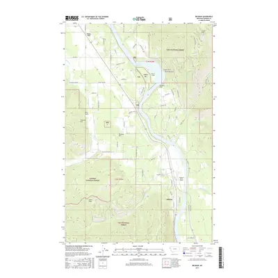
2017 Map of Belknap
USGS Topo · Published 2017About this map
Noxon Reservoir dominates the Clark Fork valley in this region of Sanders County, where the river's path is carved between the Lolo National Forest and Kaniksu National Forest. The map documents the small riverside settlements of Belknap and Talc, along with White Pine further north. Distinctive terrain features such as The Blue Slide and Finley Flats overlook the water, while the high country is marked by Cougar Peak and Sievers Ridge.
Find a feature on this map
64 named features on this map. Tap any name to fly to it.
Don’t see what you’re looking for? This feature index may not catch every label — zoom into the map to look around manually.
Map Details
Editions of this 2017 Belknap Map
This is the sole edition of this map. No revisions or reprints were ever made.
Other maps of this area

1932 · Trout Creek
USGS Topo · 1:125,000

1935 · Trout Creek
USGS Topo · 1:125,000

1936 · Trout Creek
USGS Topo · 1:125,000

1937 · Thompson Falls
USGS Topo · 1:125,000

1937 · Thompson Falls
USGS Topo · 1:62,500

1956 · Cooper Gulch
USGS Topo · 1:62,500

1956 · Wallace
USGS Topo · 1:250,000

1957 · Thompson Falls
USGS Topo · 1:62,500

1960 · Wallace
USGS Topo · 1:250,000

1966 · Vermilion Peak
USGS Topo · 1:24,000