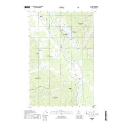
2020 Map of Belknap
USGS Topo · Published 2020About this map
White Pine and Belknap anchor this section of Sanders County, where the Clark Fork river valley is dominated by the Noxon Reservoir. The map illustrates a landscape defined by industrial and recreational access, with the Talc mining site situated near the reservoir's edge at Finley Flats. Local transportation and utility are highlighted by the presence of both the Littlebear Airport and Pinehurst Ranch Airport, serving this corner of the Lolo National Forest.
Find a feature on this map
67 named features on this map. Tap any name to fly to it.
Don’t see what you’re looking for? This feature index may not catch every label — zoom into the map to look around manually.
Map Details
Editions of this 2020 Belknap Map
This is the sole edition of this map. No revisions or reprints were ever made.
Other maps of this area

1932 · Trout Creek
USGS Topo · 1:125,000

1935 · Trout Creek
USGS Topo · 1:125,000

1936 · Trout Creek
USGS Topo · 1:125,000

1937 · Thompson Falls
USGS Topo · 1:125,000

1937 · Thompson Falls
USGS Topo · 1:62,500

1956 · Cooper Gulch
USGS Topo · 1:62,500

1956 · Wallace
USGS Topo · 1:250,000

1957 · Thompson Falls
USGS Topo · 1:62,500

1960 · Wallace
USGS Topo · 1:250,000

1966 · Vermilion Peak
USGS Topo · 1:24,000