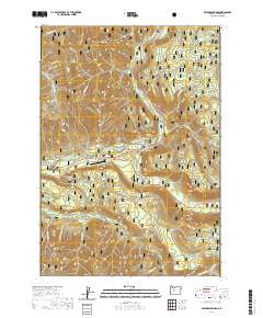
2020 Map of Belknap Springs
USGS Topo · Published 2020About this map
Belknap Springs and the surrounding wilderness of the Willamette National Forest define this 2020 landscape in the Cascade Range. The area is shaped by geothermal activity and the drainage systems of the McKenzie River and Horse Creek. Geothermal sites like Belknap Hot Spring and Foley Hot Springs are central landmarks, indicating the long-standing recreational and medicinal draw of the region.
Find a feature on this map
56 named features on this map. Tap any name to fly to it.
Don’t see what you’re looking for? This feature index may not catch every label — zoom into the map to look around manually.
Map Details
Editions of this 2020 Belknap Springs Map
This is the sole edition of this map. No revisions or reprints were ever made.
Other maps of this area

1929 · Three Sisters
USGS Topo · 1:125,000

1932 · Three Sisters
USGS Topo · 1:125,000

1934 · Mc Kenzie Bridge
USGS Topo · 1:96,000

1940 · Mc Kenzie Bridge
USGS Topo · 1:125,000

1953 · Salem
USGS Topo · 1:250,000

1954 · Salem
USGS Topo · 1:250,000

1955 · Echo Mountain
USGS Topo · 1:62,500

1955 · Mc Kenzie Bridge
USGS Topo · 1:62,500

1955 · Bend
USGS Topo · 1:250,000

1957 · Bend
USGS Topo · 1:250,000