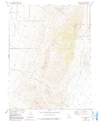
1972 Map of Bell Canyon
USGS Topo · Published 1991About this map
The Nevada Hills Mine and its accompanying tailings define the northern slopes of this desert landscape, where historical mining activity meets modern military utility. During the early 1970s, this area of Churchill County was characterized by a concentration of silver and gold prospects, including the Mizpah Mine, Gold Coin Mine, and Bell Mountain Mine. These sites are linked by a network of four-wheel-drive trails that navigate the steep terrain between Fairview Peak and Slate Mountain. The western portion of the map is dominated by the Fairview Valley, a broad depression largely occupied by the U S Naval Reservation (Target Area). Geologic features are prominent throughout, with numerous fault lines bisecting the mountains and several prospect locations near the drainage of Bell Canyon, which terminates in the alkaline expanse of Bell Flat and the Bell-Flat Well.
Find a feature on this map
25 named features on this map. Tap any name to fly to it.
Don’t see what you’re looking for? This feature index may not catch every label — zoom into the map to look around manually.
Map Details
Editions of this 1972 Bell Canyon Map
2 editions found
Other maps of this area

1908 · Carson Sink
USGS Topo · 1:250,000

1910 · Carson Sink
USGS Topo · 1:250,000

1957 · Reno
USGS Topo · 1:250,000

1959 · Reno
USGS Topo · 1:250,000

1960 · Reno
USGS Topo · 1:250,000
1972 · Bell Mountain
USGS Topo · 1:24,000
1972 · Slate Mtn
USGS Topo · 1:24,000
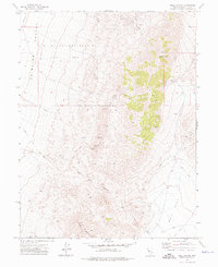
1972 · Bell Canyon
USGS Topo · 1:24,000
1972 · Broken Hills
USGS Topo · 1:24,000
1972 · West Gate
USGS Topo · 1:24,000