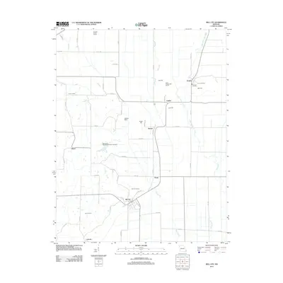
2012 Map of Bell City
USGS Topo · Published 2012About this map
Bell City serves as the focal point of this lowland landscape, where the flat alluvial plains are punctuated by an archipelago of distinct rises. These upland features, including Lost Hill, Cow Hill, and Bird Hill, provide a stark contrast to the surrounding drainage networks of Upper Whitewater Creek and Little River. The settlement pattern follows these elevations and established corridors, with small communities like Tillman, Messler, and Perkins connected by a grid of county roads. The importance of local genealogy is evident in the numerous burial grounds scattered throughout the area, such as Troph Cemetery, Plainview Cemetery, and Darus Cemetery. Aviation infrastructure is also present with Georger Farms Airport and E A A Chapter 453 Airport serving the region's agricultural needs. This 2012 documentation illustrates a highly managed water system featuring Ash Slough, Mill Slough, and the Andersons Whippoorwill Farm Lake Dam.
Find a feature on this map
55 named features on this map. Tap any name to fly to it.
Don’t see what you’re looking for? This feature index may not catch every label — zoom into the map to look around manually.
Map Details
Editions of this 2012 Bell City Map
This is the sole edition of this map. No revisions or reprints were ever made.
Other maps of this area

1931 · Sikeston
USGS Topo · 1:62,500

1934 · Morley
USGS Topo · 1:62,500

1934 · Bloomfield
USGS Topo · 1:62,500

1934 · Sikeston
USGS Topo · 1:62,500

1934 · Advance
USGS Topo · 1:62,500

1939 · Bloomfield
USGS Topo · 1:62,500

1939 · Sikeston
USGS Topo · 1:62,500

1939 · Morley
USGS Topo · 1:62,500

1939 · Advance
USGS Topo · 1:62,500

1949 · Paducah
USGS Topo · 1:250,000