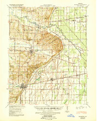
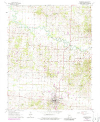
1939 Map of Bloomfield
USGS Topo · Published 1939About this map
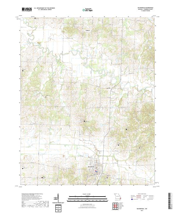
The Castor River meanders through this portion of Stoddard County, defining a landscape at the edge of the Mississippi embayment where high ground meets reclaimed bottomlands. A massive network of drainage infrastructure, including the Dudley Main Ditch and numerous numbered channels like Ditch No 24, illustrates the intensive efforts to transform the swampy lowlands for agriculture. This transition is anchored by the county seat of Bloomfield, which sits atop the ridge overlooking the managed waters of Lick Creek.
Find a feature on this map
98 named features on this map. Tap any name to fly to it.
Don’t see what you’re looking for? This feature index may not catch every label — zoom into the map to look around manually.
Map Details
Editions of this 1939 Bloomfield Map
This is the sole edition of this map. No revisions or reprints were ever made.
Historical Maps of Dexter Through Time
9 maps found
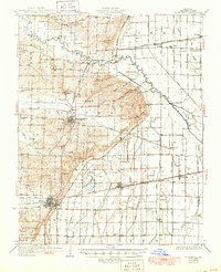
1934 Bloomfield
Stoddard County, MO
1939 Bloomfield
Stoddard County, MO
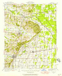
1949 Bloomfield
Stoddard County, MO
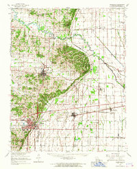
1963 Bloomfield
Stoddard County, MO
1963 Bloomfield
Stoddard County, MO
2012 Bloomfield
Stoddard County, MO
2015 Bloomfield
Stoddard County, MO
2017 Bloomfield
Stoddard County, MO
2021 Bloomfield
Stoddard County, MO