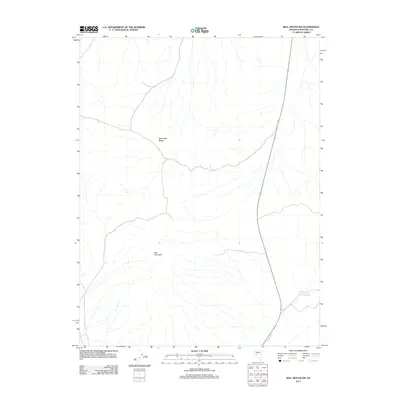
2011 Map of Bell Mountain
USGS Topo · Published 2011About this map
Bell Mountain and the West Gate Range define this arid landscape in Churchill County, where high desert elevations meet the drainage of Gabbs Wash. This 2011 survey illustrates the modern transportation corridor cutting through the Great Basin, dominated by a primary highway route that follows the low-lying terrain between these prominent ranges. The sparse label set reflects a high-desert environment where water is the primary geographic driver, notably through the seasonal drainage system of the wash in the southeastern corner. The map provides a precise record of the topography and modern roadway alignment, showing how human infrastructure adapts to the significant vertical relief of the Nevada interior.
Find a feature on this map
3 named features on this map. Tap any name to fly to it.
Don’t see what you’re looking for? This feature index may not catch every label — zoom into the map to look around manually.
Map Details
Editions of this 2011 Bell Mountain Map
This is the sole edition of this map. No revisions or reprints were ever made.
Other maps of this area

1908 · Carson Sink
USGS Topo · 1:250,000

1910 · Carson Sink
USGS Topo · 1:250,000

1955 · Millett
USGS Topo · 1:250,000

1957 · Reno
USGS Topo · 1:250,000

1959 · Reno
USGS Topo · 1:250,000

1959 · Millett
USGS Topo · 1:250,000

1960 · Reno
USGS Topo · 1:250,000
1969 · Quartz Mtn
USGS Topo · 1:24,000
1969 · Quartzite Mtn NW
USGS Topo · 1:24,000

1969 · Eastgate
USGS Topo · 1:24,000