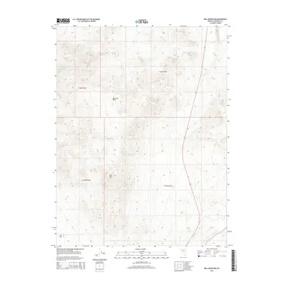
2014 Map of Bell Mountain
USGS Topo · Published 2014About this map
Bell Mtn rises prominently within this part of Churchill County, anchoring a high-desert landscape defined by the West Gate Range. This 2014 survey documents the topography of the Great Basin, where the steep ridgelines of the range give way to the broad expanse of Bell Flat to the southwest. The presence of Gabbs Wash in the southeastern corner highlights the seasonal drainage patterns typical of this arid region, illustrating how water moving through the basin floor has shaped the land over time. The map provides a detailed view of the Public Land Survey System divisions, including t16n r35e and t15n r34e, which define the administrative grid of this open terrain.
Find a feature on this map
8 named features on this map. Tap any name to fly to it.
Don’t see what you’re looking for? This feature index may not catch every label — zoom into the map to look around manually.
Map Details
Editions of this 2014 Bell Mountain Map
This is the sole edition of this map. No revisions or reprints were ever made.
Other maps of this area

1908 · Carson Sink
USGS Topo · 1:250,000

1910 · Carson Sink
USGS Topo · 1:250,000

1955 · Millett
USGS Topo · 1:250,000

1957 · Reno
USGS Topo · 1:250,000

1959 · Reno
USGS Topo · 1:250,000

1959 · Millett
USGS Topo · 1:250,000

1960 · Reno
USGS Topo · 1:250,000
1969 · Quartz Mtn
USGS Topo · 1:24,000
1969 · Quartzite Mtn NW
USGS Topo · 1:24,000

1969 · Eastgate
USGS Topo · 1:24,000