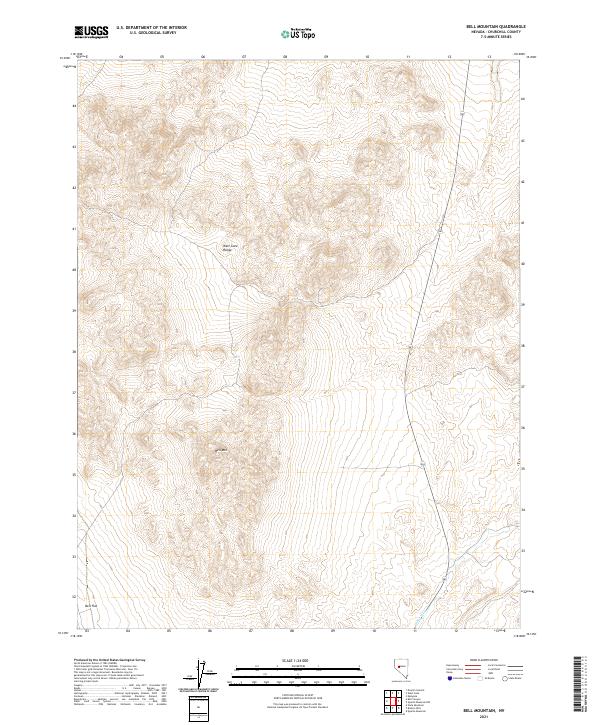
2021 Map of Bell Mountain
USGS Topo · Published 2021About this map
Bell Mountain and the West Gate Range define this high-altitude landscape in Churchill County, where dramatic elevation changes are documented by the U.S. Department of the Interior. The terrain drops into the expansive Bell Flat to the southwest, while the seasonal drainage of Gabbs Wash cuts through the southeastern corner of the quadrangle. This 2021 survey utilizes high-resolution data from the National Elevation Dataset and imagery from the National Agriculture Imagery Program to illustrate the complex topography of the Great Basin. The map provides a detailed view of the township and range system, including t16n r34e, t16n r35e, t15n r34e, and t15n r35e, which serves as a foundational reference for land management and geological study in this remote region of Nevada.
Find a feature on this map
8 named features on this map. Tap any name to fly to it.
Don’t see what you’re looking for? This feature index may not catch every label — zoom into the map to look around manually.
Map Details
Editions of this 2021 Bell Mountain Map
This is the sole edition of this map. No revisions or reprints were ever made.
Other maps of this area

1908 · Carson Sink
USGS Topo · 1:250,000

1910 · Carson Sink
USGS Topo · 1:250,000

1955 · Millett
USGS Topo · 1:250,000

1957 · Reno
USGS Topo · 1:250,000

1959 · Reno
USGS Topo · 1:250,000

1959 · Millett
USGS Topo · 1:250,000

1960 · Reno
USGS Topo · 1:250,000
1969 · Quartz Mtn
USGS Topo · 1:24,000
1969 · Quartzite Mtn NW
USGS Topo · 1:24,000

1969 · Eastgate
USGS Topo · 1:24,000