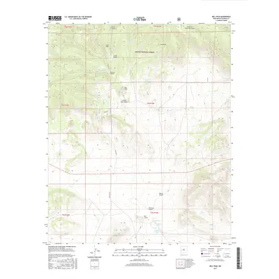
2017 Map of Bell Peak
USGS Topo · Published 2017About this map
The Apache National Forest dominates this high-altitude section of Catron County, defined by a complex system of drainage canyons and cattle tanks. The prominence of Bell Peak serves as a central landmark, surrounded by name-rich terrain such as Landing Camp Canyon and Ladies Canyon. This 2017 survey details a landscape where water management is critical to the local geography, evidenced by numerous named reservoirs including Upper Barreras Tank, Francisco Tank, and E Sanchez Tank. To the south, the terrain descends toward Patterson Lake, which is fed by Paterson Spring and Sotolee Spring. The map documents the primitive road network essential for navigating this remote region, specifically Mangas Rd and Bursum Rd, which follow the natural contours of the ridges and canyon floors.
Find a feature on this map
34 named features on this map. Tap any name to fly to it.
Don’t see what you’re looking for? This feature index may not catch every label — zoom into the map to look around manually.
Map Details
Editions of this 2017 Bell Peak Map
This is the sole edition of this map. No revisions or reprints were ever made.
Other maps of this area

1918 · Pelona
USGS Topo · 1:125,000

1954 · Clifton
USGS Topo · 1:250,000

1954 · Saint Johns
USGS Topo · 1:250,000

1957 · Clifton
USGS Topo · 1:250,000

1957 · Saint Johns
USGS Topo · 1:250,000

1958 · Clifton
USGS Topo · 1:250,000

1958 · Saint Johns
USGS Topo · 1:250,000

1962 · Clifton
USGS Topo · 1:250,000

1962 · Saint Johns
USGS Topo · 1:250,000

1981 · Fullerton
USGS Topo · 1:24,000