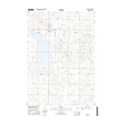
2017 Map of Bellaire
USGS Topo · Published 2017About this map
Bellaire serves as the focal point of this northern Michigan landscape, situated at the confluence of the Intermediate River and the Cedar River. The town is the hub of a complex hydrographic system known as the Chain of Lakes, including Intermediate Lake to the north and the expansive Lake Bellaire to the south. The 2017 terrain shows a mix of recreational development and established civic history, evidenced by a series of cemeteries such as Lakeview Cem and Fairview Cem. To the east, the topography rises sharply toward Schuss Mountain, where specialized road names like Schuss Mountain Dr and Rue De Montagne indicate the area's transition into a resort and skiing destination. Further south, the map documents the natural flow of the Grass River as it connects larger water bodies, passing through the Grass River Natural Area RD. These waterways remain central to the region's identity, linking residential pockets like North Arms with the surrounding woodlands.
Find a feature on this map
127 named features on this map. Tap any name to fly to it.
Don’t see what you’re looking for? This feature index may not catch every label — zoom into the map to look around manually.
Map Details
Editions of this 2017 Bellaire Map
This is the sole edition of this map. No revisions or reprints were ever made.
Other maps of this area

1954 · Central Lake
USGS Topo · 1:62,500

1954 · Traverse City
USGS Topo · 1:250,000

1955 · Cheboygan
USGS Topo · 1:250,000

1956 · Mancelona
USGS Topo · 1:62,500

1957 · Elk Rapids
USGS Topo · 1:62,500

1958 · Cheboygan
USGS Topo · 1:250,000

1958 · Traverse City
USGS Topo · 1:250,000

1961 · Boyne City
USGS Topo · 1:62,500

1975 · Mancelona NE
USGS Topo · 1:24,000

1975 · Mancelona NW
USGS Topo · 1:24,000