2023 Map of Bellaire
USGS Topo · Published 2023About this map
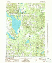
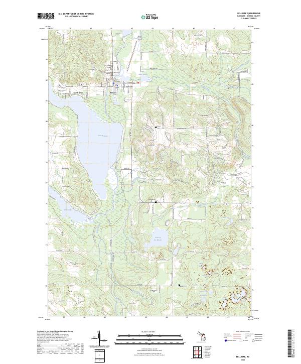
Bellaire serves as the focal point of this Antrim County landscape, situated where the Intermediate River flows into the expansive Lake Bellaire. The map documents a complex water network essential to the region's identity, featuring the Chain of Lakes Water Trl and various smaller basins such as Lake of the Woods, Finn Lake, and Bates Lake. This modern survey illustrates the residential and recreational development surrounding these glacial lakes, from the organized streets of the village to the winding roads of North Arms.
Find a feature on this map
79 named features on this map. Tap any name to fly to it.
Don’t see what you’re looking for? This feature index may not catch every label — zoom into the map to look around manually.
Map Details
Editions of this 2023 Bellaire Map
This is the sole edition of this map. No revisions or reprints were ever made.