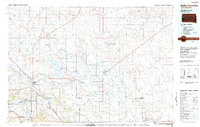
1983 Map of Belle Fourche
USGS Topo · Published 1983About this map
The Beller Fourche River and Redwater River converge at the western edge of this 1980s landscape, anchoring a region where irrigation and ranching intersect. Large water management features dominate the central plains, specifically the massive Belle Fourche Reservoir and the Newell Lake State Game Production Area, supporting the agricultural communities of Fruitdale, Nisland, and Newell. The map illustrates the logistical backbone of the Black Hills foothills, tracing the Chicago and North Western rail line as it connects the hub of Belle Fourche with smaller shipping points like Vale.
Find a feature on this map
79 named features on this map. Tap any name to fly to it.
Don’t see what you’re looking for? This feature index may not catch every label — zoom into the map to look around manually.
Map Details
Editions of this 1983 Belle Fourche Map
This is the sole edition of this map. No revisions or reprints were ever made.
Other maps of this area

1893 · Rapid
USGS Topo · 1:125,000

1894 · Deadwood
USGS Topo · 1:125,000

1898 · Sundance
USGS Topo · 1:125,000

1898 · Rapid
USGS Topo · 1:125,000

1899 · Sturgis
USGS Topo · 1:62,500

1900 · Spearfish
USGS Topo · 1:62,500

1901 · Deadwood
USGS Topo · 1:125,000

1901 · Aladdin
USGS Topo · 1:125,000

1902 · Sundance
USGS Topo · 1:125,000

1903 · Aladdin
USGS Topo · 1:125,000