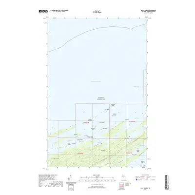
2019 Map of Belle Harbor
USGS Topo · Published 2019About this map
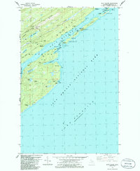
Isle Royale National Park dominates this northern stretch of Michigan, where the waters of Lake Superior meet a complex shoreline of inlets and offshore islands. The topography is defined by the prominent Greenstone Ridge Trail, which follows the island's interior spine past Mt Franklin. The map detail reveals the intricate geography of the northeastern harbor system, including Tobin Harbor, Rock Harbor, and Duncan Bay. Numerous small islands, such as Captain Kidd Island and Belle Isle, serve as landmarks for navigation along the jagged coast. This wilderness landscape is primarily accessed by footpaths like the Lane Cove Trail and the Tobin Harbor Trail, illustrating the remote character of the island’s trail network and its protected interior lakes like Lake Ahmik and Patterson Lake.
Find a feature on this map
51 named features on this map. Tap any name to fly to it.
Don’t see what you’re looking for? This feature index may not catch every label — zoom into the map to look around manually.
Map Details
Editions of this 2019 Belle Harbor Map
This is the sole edition of this map. No revisions or reprints were ever made.
Other maps of this area

1895 · Passage Island
USGS Topo · 1:62,500

1959 · Fort William
USGS Topo · 1:250,000

1968 · Fort William
USGS Topo · 1:250,000

1985 · Todd Harbor
USGS Topo · 1:100,000
1985 · McCargoe Cove
USGS Topo · 1:24,000
1985 · Rock Harbor Lodge
USGS Topo · 1:24,000
1985 · Belle Harbor
USGS Topo · 1:24,000
1985 · Mott Island
USGS Topo · 1:24,000
2011 · Lake Richie
USGS Topo · 1:24,000
2011 · Belle Harbor
USGS Topo · 1:24,000