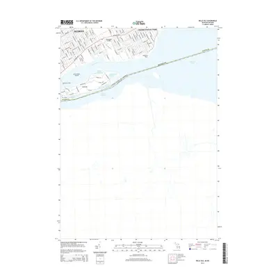
2014 Map of Belle Isle
USGS Topo · Published 2014About this map
Belle Isle serves as the focal point of this riverine landscape, situated in the Detroit River between Michigan and the international boundary with Canada. The island's internal geography is detailed with a network of carriage roads and recreational water bodies, including Lake Muskoday, Lake Okonoka, and Blue Heron Lagoon. Connection to the mainland is maintained via the MacArthur Bridge, leading into the urban grid of Detroit. To the northeast, the map transitions into the residential waterfront of Grosse Pointe Park, where streets terminate at the banks of the river near Windmill Point. The industrial and infrastructure legacy of the area is represented by Conners Creek and the expansive maritime views toward Lake Saint Clair, illustrating the complex relationship between Detroit's urban core and its historic parklands.
Find a feature on this map
30 named features on this map. Tap any name to fly to it.
Don’t see what you’re looking for? This feature index may not catch every label — zoom into the map to look around manually.
Map Details
Editions of this 2014 Belle Isle Map
This is the sole edition of this map. No revisions or reprints were ever made.
Other maps of this area

1905 · Detroit
USGS Topo · 1:62,500

1905 · Grosse Pointe
USGS Topo · 1:62,500

1906 · Wyandotte
USGS Topo · 1:62,500

1912 · Wyandotte
USGS Topo · 1:62,500

1918 · Detroit
USGS Topo · 1:62,500

1918 · Grosse Pointe
USGS Topo · 1:62,500

1924 · Detroit
USGS Topo · 1:62,500

1929 · Wyandotte
USGS Topo · 1:62,500

1934 · Detroit
USGS Topo · 1:62,500
1936 · Highland Park
USGS Topo · 1:31,680