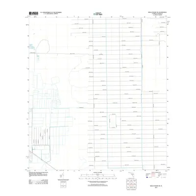
2012 Map of Belle Meade SE
USGS Topo · Published 2012About this map
Grid-patterned access roads and rural agricultural tracks define this landscape in Collier County, Florida, as seen in the early 21st century. The map shows an extensive network of parallel thoroughfares, such as 62nd Ave SE through 128th Ave SE, intersected by primary north-south connectors like Miller Blvd and Stewart Blvd. The western portion of the quadrangle reveals specialized infrastructure and local lanes like Six L's Farm Rd, Tomato Rd, and Ladybug Ln, suggesting a landscape dominated by large-scale farming operations and irrigation. To the east, Canal Rd and Naomi St follow the straight-line drainage and transport corridors typical of the Florida Everglades fringe. This layout illustrates the systematic division of land for agricultural production and future residential expansion in the Belle Meade area.
Find a feature on this map
55 named features on this map. Tap any name to fly to it.
Don’t see what you’re looking for? This feature index may not catch every label — zoom into the map to look around manually.
Map Details
Editions of this 2012 Belle Meade SE Map
This is the sole edition of this map. No revisions or reprints were ever made.
Other maps of this area

1956 · Miami
USGS Topo · 1:250,000

1956 · West Palm Beach
USGS Topo · 1:250,000

1957 · West Palm Beach
USGS Topo · 1:250,000

1958 · West Palm Beach
USGS Topo · 1:250,000

1958 · Miami
USGS Topo · 1:250,000

1958 · Belle Meade
USGS Topo · 1:24,000

1958 · Catherine Island
USGS Topo · 1:24,000

1958 · Belle Meade NE
USGS Topo · 1:24,000

1958 · Belle Meade NW
USGS Topo · 1:24,000

1958 · Belle Meade SE
USGS Topo · 1:24,000