
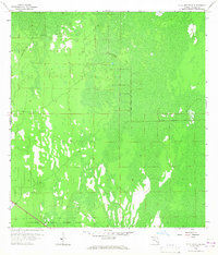
1958 Map of Belle Meade SE
USGS Topo · Published 1959About this map
Collier Seminole State Park anchors the southern boundary of this 1950s survey, representing a vast expanse of South Florida wetlands and cypress strands. The terrain is defined by its saturation and lack of permanent settlements, with much of the map dedicated to marshy ground and periodic water bodies. Evidence of past human industry and transit is etched into this landscape through the Old Railroad Grade, which suggests an era of timber extraction or early transportation efforts that preceded the modern park designation. Access into the interior remains limited to primitive tracks like Mule Lot Road and a solitary Jeep Trail, highlighting the persistence of this wilderness even as the surrounding region began to develop. This sheet is particularly useful for understanding the historic drainage patterns of the Everglades before extensive modern alterations.
Find a feature on this map
4 named features on this map. Tap any name to fly to it.
Don’t see what you’re looking for? This feature index may not catch every label — zoom into the map to look around manually.
Map Details
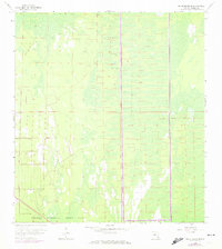
Editions of this 1958 Belle Meade SE Map
3 editions found
Other maps of this area

1956 · Miami
USGS Topo · 1:250,000

1956 · West Palm Beach
USGS Topo · 1:250,000

1957 · West Palm Beach
USGS Topo · 1:250,000

1958 · West Palm Beach
USGS Topo · 1:250,000

1958 · Miami
USGS Topo · 1:250,000

1958 · Belle Meade
USGS Topo · 1:24,000

1958 · Catherine Island
USGS Topo · 1:24,000

1958 · Belle Meade NE
USGS Topo · 1:24,000

1958 · Belle Meade NW
USGS Topo · 1:24,000

1959 · Deep Lake SW
USGS Topo · 1:24,000