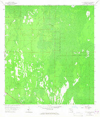
1958 Map of Belle Meade SE
USGS Topo · Published 1967About this map
Collier Seminole State Park occupies the southern edge of this landscape, representing a significant conservation effort in the Florida Everglades. This terrain is defined by its low-lying marshes and dense cypress heads, where land and water are inextricably linked. Human intervention in this wilderness is evidenced by the Old Railroad Grade and a network of Jeep Trails that snake through the wetland, remnants of industrial or logging pursuits that preceded the area's preservation. The map, based on aerial photography from the early 1950s and ground surveys from 1957–1958, provides a technical view of the drainage patterns and township boundaries, including the line between T. 50 S. and T. 51 S. which segments this portion of Collier County.
Find a feature on this map
4 named features on this map. Tap any name to fly to it.
Don’t see what you’re looking for? This feature index may not catch every label — zoom into the map to look around manually.
Map Details
Editions of this 1958 Belle Meade SE Map
3 editions found
Other maps of this area

1956 · Miami
USGS Topo · 1:250,000

1956 · West Palm Beach
USGS Topo · 1:250,000

1957 · West Palm Beach
USGS Topo · 1:250,000

1958 · West Palm Beach
USGS Topo · 1:250,000

1958 · Miami
USGS Topo · 1:250,000

1958 · Belle Meade
USGS Topo · 1:24,000

1958 · Catherine Island
USGS Topo · 1:24,000

1958 · Belle Meade NE
USGS Topo · 1:24,000

1958 · Belle Meade NW
USGS Topo · 1:24,000

1958 · Belle Meade SE
USGS Topo · 1:24,000