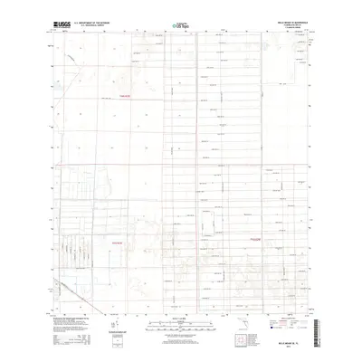
2015 Map of Belle Meade SE
USGS Topo · Published 2015About this map
Sabal Palm Rd and Everglades Blvd S anchor a rigid, expansive grid of residential and agricultural corridors in this part of Collier County. The map reveals the precise geometry of South Florida's late-twentieth-century land development, where long, straight avenues like 62nd Ave SE and 104th Ave SE stretch across the landscape. This particular survey highlights the transition from the structured plots along Miller Blvd to the more open terrain intersected by Rifle Range Rd. The layout reflects the systematic platting characteristic of the region, illustrating how massive tracts were organized into a rhythmic pattern of boulevards and numbered streets. While many of these corridors remain largely rural or sparsely settled, the presence of thoroughfares like Sher Blvd and Stewart Blvd indicates the foundational infrastructure laid for future growth in the region.
Find a feature on this map
60 named features on this map. Tap any name to fly to it.
Don’t see what you’re looking for? This feature index may not catch every label — zoom into the map to look around manually.
Map Details
Editions of this 2015 Belle Meade SE Map
This is the sole edition of this map. No revisions or reprints were ever made.
Other maps of this area

1956 · Miami
USGS Topo · 1:250,000

1956 · West Palm Beach
USGS Topo · 1:250,000

1957 · West Palm Beach
USGS Topo · 1:250,000

1958 · West Palm Beach
USGS Topo · 1:250,000

1958 · Miami
USGS Topo · 1:250,000

1958 · Belle Meade
USGS Topo · 1:24,000

1958 · Catherine Island
USGS Topo · 1:24,000

1958 · Belle Meade NE
USGS Topo · 1:24,000

1958 · Belle Meade NW
USGS Topo · 1:24,000

1958 · Belle Meade SE
USGS Topo · 1:24,000