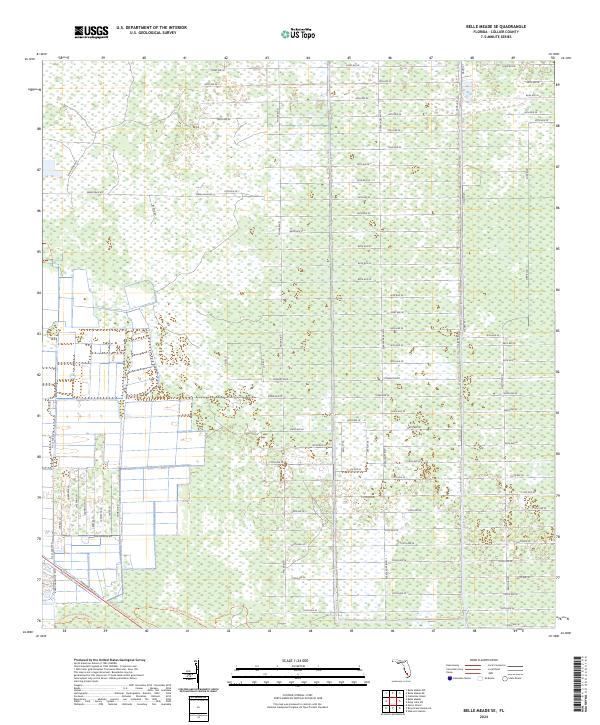
2024 Map of Belle Meade SE
USGS Topo · Published 2024About this map
Grid-based rural development and wetlands dominate this modern survey of Collier County. The landscape is defined by a rigid system of east-west corridors, including 62nd Ave SE and 78th Ave SE, which slice through the south Florida interior. This geometry reflects the systematic township and range divisions of T50s R27e and T51s R27e, where many of these routes likely represent planned access or drainage infrastructure. To the south, the network continues with routes like 104th Ave SE and 114th Ave SE, illustrating the ongoing expansion and management of this low-lying region. The map provides a precise account of the modern interface between human engineering and the natural Florida environment, where roads are the primary indicators of regional planning and land use.
Find a feature on this map
62 named features on this map. Tap any name to fly to it.
Don’t see what you’re looking for? This feature index may not catch every label — zoom into the map to look around manually.
Map Details
Editions of this 2024 Belle Meade SE Map
This is the sole edition of this map. No revisions or reprints were ever made.
Other maps of this area

1956 · Miami
USGS Topo · 1:250,000

1956 · West Palm Beach
USGS Topo · 1:250,000

1957 · West Palm Beach
USGS Topo · 1:250,000

1958 · West Palm Beach
USGS Topo · 1:250,000

1958 · Miami
USGS Topo · 1:250,000

1958 · Belle Meade
USGS Topo · 1:24,000

1958 · Catherine Island
USGS Topo · 1:24,000

1958 · Belle Meade NE
USGS Topo · 1:24,000

1958 · Belle Meade NW
USGS Topo · 1:24,000

1958 · Belle Meade SE
USGS Topo · 1:24,000