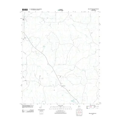
2012 Map of Bellefontaine
USGS Topo · Published 2012About this map
Bellefontaine and the surrounding Webster County countryside appear in this 2012 survey as a landscape defined by small rural hubs and numerous family cemeteries. The settlement of Slate Spring anchors the northwest corner, while Embry and Bellefontaine are situated in the southern half of the sheet, connected by MS Highway 404. This era shows a community structured around its creeks and local roads, with Sabougla Creek and Shutispear Cr carving paths through the terrain.
Find a feature on this map
57 named features on this map. Tap any name to fly to it.
Don’t see what you’re looking for? This feature index may not catch every label — zoom into the map to look around manually.
Map Details
Editions of this 2012 Bellefontaine Map
This is the sole edition of this map. No revisions or reprints were ever made.
Other maps of this area

1953 · Walthall
USGS Topo · 1:62,500

1953 · West Point
USGS Topo · 1:250,000

1954 · Pittsboro
USGS Topo · 1:62,500

1958 · West Point
USGS Topo · 1:250,000

1963 · West Point
USGS Topo · 1:250,000

1972 · Atlanta
USGS Topo · 1:24,000

1972 · Sapa
USGS Topo · 1:24,000

1972 · Hohenlinden
USGS Topo · 1:24,000
1976 · Pittsboro SE
USGS Topo · 1:24,000
1976 · Walthall SE
USGS Topo · 1:24,000