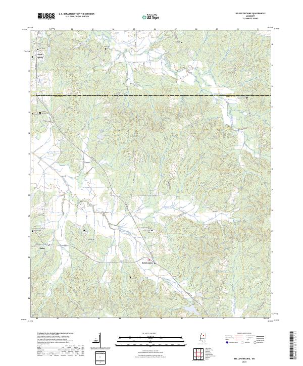
2024 Map of Bellefontaine
USGS Topo · Published 2024About this map
Bellefontaine and Embry sit along the winding path of Bellefontaine Creek in this part of Webster County. The landscape is characterized by its numerous family burial grounds and country churches, which offer a significant resource for genealogical research. Notable sites include the Zinn Family Cem, Pilgrim's Rest Baptist Church Cem, and the Lovette Cem, scattered across the undulating terrain between Sabougla Creek and Shutispear Creek. To the north, the boundary between Calhoun and Webster counties cuts through the area near Slate Spring. The network of county roads, such as Co RD 251 and Macon Rd, connects these small rural hubs, illustrating a settlement pattern deeply rooted in the agricultural geography of North Mississippi. Dorroh Lake and Little Black Creek further define the local drainage, highlighting the area's reliance on these small watercourses for land division and movement.
Find a feature on this map
66 named features on this map. Tap any name to fly to it.
Don’t see what you’re looking for? This feature index may not catch every label — zoom into the map to look around manually.
Map Details
Editions of this 2024 Bellefontaine Map
This is the sole edition of this map. No revisions or reprints were ever made.
Other maps of this area

1953 · Walthall
USGS Topo · 1:62,500

1953 · West Point
USGS Topo · 1:250,000

1954 · Pittsboro
USGS Topo · 1:62,500

1958 · West Point
USGS Topo · 1:250,000

1963 · West Point
USGS Topo · 1:250,000

1972 · Atlanta
USGS Topo · 1:24,000

1972 · Sapa
USGS Topo · 1:24,000

1972 · Hohenlinden
USGS Topo · 1:24,000
1976 · Pittsboro SE
USGS Topo · 1:24,000
1976 · Walthall SE
USGS Topo · 1:24,000