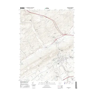
2016 Map of Bellefonte
USGS Topo · Published 2016About this map
Bellefonte serves as the regional hub in this 2016 survey, anchored by its historic core and surrounded by established neighborhoods like Park View Heights and East End. The landscape is sharply defined by the presence of Bald Eagle Mountain and Trcziyulny Mtn, which funnel the waters of Spring Creek and Bald Eagle Creek through the valley. This geography historically dictated the placement of industry and transit, evident in the cluster of settlements including Milesburg, Unionville, and Coleville. Significant local landmarks include Bellefonte Airport and the trout-fishing waters of Fishermans Paradise. Genealogists will find several burial grounds documented, including Union Cem, Saint Johns Cem, and Trcziyulny Cem. The map illustrates a modern community still oriented around the limestone-rich valleys and watercourses that first drew settlers to central Pennsylvania.
Find a feature on this map
131 named features on this map. Tap any name to fly to it.
Don’t see what you’re looking for? This feature index may not catch every label — zoom into the map to look around manually.
Map Details
Editions of this 2016 Bellefonte Map
This is the sole edition of this map. No revisions or reprints were ever made.
Other maps of this area

1908 · Bellefonte
USGS Topo · 1:62,500

1909 · Bellefonte
USGS Topo · 1:62,500

1921 · Howard
USGS Topo · 1:48,000

1923 · Howard
USGS Topo · 1:62,500

1924 · Centre Hall
USGS Topo · 1:62,500

1928 · Snow Shoe
USGS Topo · 1:48,000

1929 · Centre Hall
USGS Topo · 1:62,500

1931 · Show Shoe
USGS Topo · 1:62,500

1943 · Lewistown
USGS Topo · 1:125,000

1950 · Harrisburg
USGS Topo · 1:250,000