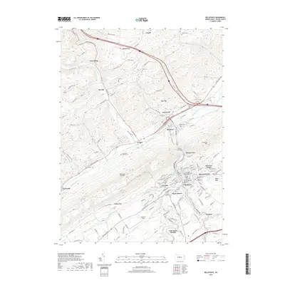
2019 Map of Bellefonte
USGS Topo · Published 2019About this map
Bellefonte serves as the focal point of this central Pennsylvania study, showcasing its status as a civic hub with the Centre County Courthouse situated at its heart. The landscape is defined by the significant convergence of Bald Eagle Creek and Spring Creek, watercourses that shaped the development of surrounding communities like Milesburg and Unionville. This 2019 survey captures the modern extent of residential areas such as Bush Addition, Park View Heights, and Pleasant View, while maintaining a record of the region's deep historical roots through a high density of burial sites. Notable for genealogists are Friends Cem Alexander Farm, the Saint John's Episcopal Church Columbarium, and the Rodef Shalom Cem. The map illustrates the varied terrain of Nittany Valley, bounded by the prominent ridge of Bald Eagle Mountain, where local transport networks including the Bellefonte Airport and winding mountain roads like Snow Shoe Mountain Rd connect the valley's disparate settlements.
Find a feature on this map
144 named features on this map. Tap any name to fly to it.
Don’t see what you’re looking for? This feature index may not catch every label — zoom into the map to look around manually.
Map Details
Editions of this 2019 Bellefonte Map
This is the sole edition of this map. No revisions or reprints were ever made.
Other maps of this area

1908 · Bellefonte
USGS Topo · 1:62,500

1909 · Bellefonte
USGS Topo · 1:62,500

1921 · Howard
USGS Topo · 1:48,000

1923 · Howard
USGS Topo · 1:62,500

1924 · Centre Hall
USGS Topo · 1:62,500

1928 · Snow Shoe
USGS Topo · 1:48,000

1929 · Centre Hall
USGS Topo · 1:62,500

1931 · Show Shoe
USGS Topo · 1:62,500

1943 · Lewistown
USGS Topo · 1:125,000

1950 · Harrisburg
USGS Topo · 1:250,000